Colorado Motorcycle Travel Advisory & Route Planning
SolidRide is Colorado’s premier adventure and dual-sport motorcycle travel authority.
Colorado Travel Safety Alert
Monsoonal rain on burn scars causes rapid flash floods and mudslides across mountain passes. Track live incidents before riding.
Unlock Colorado’s Backcountry with Expert Motorcycle Travel Advisory
Skip the guess-work and execute a flawless Rocky Mountain ride. SolidRide provides comprehensive motorcycle travel advisory services designed specifically for adventure and dual-sport riders seeking total confidence in the high country. From field-vetted, custom GPX route planning tailored to your bike’s range and your skill level, to live mountain pass condition updates and high-altitude logistics consulting, we deliver the exact local intelligence you need. Whether you are tackling technical 4WD pass loops, planning a self-guided expedition, or navigating seasonal snowpack windows, our team handles the route engineering so you can focus on the ride.
High-Country Motorcycle Travel Advisory & GPX Route Consulting
Planning a self-guided Colorado motorcycle trip, tackling the COBDR, or navigating remote mountain passes? SolidRide’s travel advisory services provide the field-tested route intelligence, GPX engineering, and logistics support you need to execute a seamless high-country ride.
- Custom GPX Route Engineering: Turnkey, field-vetted GPX tracks tailored to your bike type (ADV vs. Dual-Sport), fuel range, and skill level.
- Real-Time Route Vetting & Pass Advisory: Seasonal snowpack melt-out updates, high-altitude weather timing, and live detour planning around pass closures.
- Logistics & Staging Support: Permitted staging locations, vehicle transfer coordination, and localized lodging recommendations.
Looking for Guided Tours?
Sit back and enjoy the ride while our experienced guides handle the logistics. Check out our tour calendar to view upcoming guided tour dates.
Trusted by ADV & Dual-Sport Riders
Don’t just take our word for it—see why riders consistently rate SolidRide as Colorado’s top choice for adventure motorcycle travel. From our field-vetted GPX route engineering and real-time pass condition updates to our turnkey, fully permitted guided expeditions, hear directly from the community of riders who have tackled the Rocky Mountains with us.
Meet Your Hosts
With over 30 years of riding experience and training from Road Guardians, Red Cross, and the International Guide Academy, we serve as your local destination experts—delivering epic guided experiences, custom itineraries, lodging recommendations, and on-trail leadership for an unforgettable travel experience.
Statewide Coverage & Local Destination Expertise
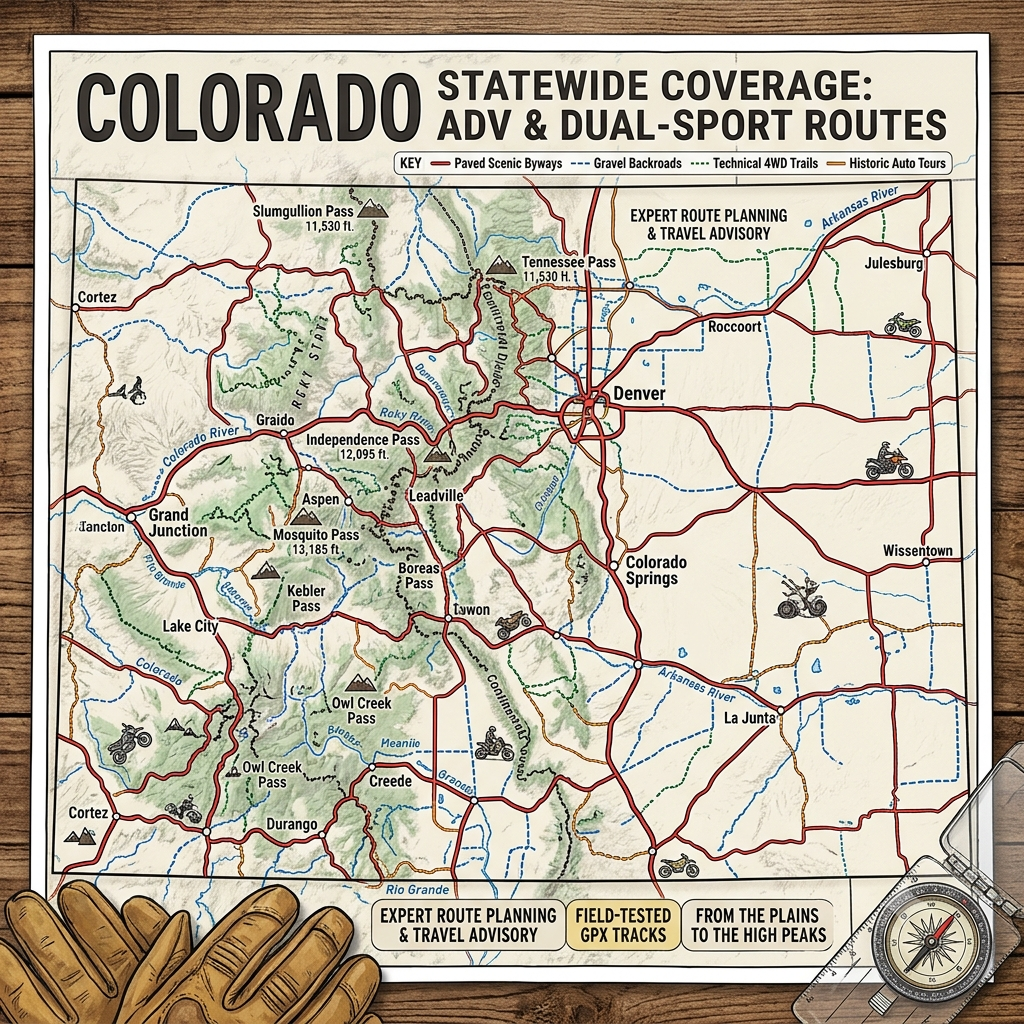
Our team brings deep, field-vetted knowledge of Colorado’s most iconic corridors, mountain passes, and backcountry routes. We maintain extensive local familiarity with all 26 official Colorado Scenic & Historic Byways, 13 U.S. Forest Service (USFS) Auto Tours, and premier landmark highways such as Pikes Peak and Garden of the Gods. Whether you are planning a sweeping paved tour or looking to tackle rugged backcountry doubletrack, our local destination intelligence connects you with the best riding corridors, staging hubs, and high-country routes across every corner of the state.
Ride Colorado’s Scenic Byway System
Colorado’s 26 official Scenic and Historic Byways offer some of the most spectacular paved and mixed-surface riding in North America. Whether you are carving the sweeping canyon turns of the Cache La Poudre or crossing 12,000-foot passes along the Alpine Loop, executing a smooth trip requires expert Colorado motorcycle route planning. Our travel advisory service takes the hassle out of self-guided motorcycle tours in Colorado by mapping out optimal staging hubs, fuel-range benchmarks, and seasonal snowpack windows for every byway corridor.
Alpine Loop
- Mountain Towns & Staging Hubs: Lake City, Ouray, Silverton, Telluride
- Region: Southwest Colorado / San Juan Mountains (Pike-San Isabel & Uncompahgre NF / BLM)
- Terrain Specifications: High-clearance 4WD doubletrack, exposed cliffside shelf roads, embedded rock, and high-alpine scree
Cache La Poudre - North Park
Traces Colorado’s only designated Wild & Scenic River through a tight granite canyon over Cameron Pass into the high-alpine bowl of North Park. We provide localized intelligence on canyon riding lines, wildlife awareness zones, and Forest Service dirt connectors branching into the Medicine Bow-Routt National Forest.
- Mountain Towns & Staging Hubs: Fort Collins, Walden, Bellvue, Red Feather Lakes
- Region: North Central Colorado (Arapaho & Roosevelt NF)
- Terrain Specifications: Smooth paved canyon sweeping turns, rising mountain pass asphalt, and optional USFS gravel logging spurs
Collegiate Peaks
Parallels the Sawatch Range along the Arkansas River Valley, offering views of the densest concentration of 14,000-foot peaks in the United States. We consult riders on tactical staging out of Buena Vista and Salida, fuel-range strategy, and access to high-pass dirt loops such as Cottonwood, Cumberland, and Tincup Passes.
- Mountain Towns & Staging Hubs: Buena Vista, Salida, Poncha Springs, Nathrop
- Region: South Central Colorado (Pike-San Isabel NF)
- Terrain Specifications: High-valley paved highway with immediate access to technical doubletrack and high-pass gravel routes
Colorado River Headwaters
Follows the nascent Colorado River from its headwaters in Rocky Mountain National Park down through Gore Canyon and rugged ranchlands. Our team maps out optimal connections between paved river sweeps and remote BLM dirt tracks around Kremmling and Radium.
- Mountain Towns & Staging Hubs: Grand Lake, Granby, Hot Sulphur Springs, Kremmling
- Region: Northwest / Central Rockies (Arapaho NF)
- Terrain Specifications: Paved river corridor, hardpack gravel, and sandy sagebrush dual-sport spurs
Dinosaur Diamond
Encompasses the stark, fossil-rich canyons of northwestern Colorado, linking Fruita, Rangely, and Dinosaur National Monument. We assist riders in preparing for high summer ambient temperatures, remote fuel stretches, and sandy canyon wash navigation.
- Mountain Towns & Staging Hubs: Grand Junction, Fruita, Rangely, Dinosaur
- Region: Northwest Colorado / Utah Border (BLM)
- Terrain Specifications: Long highway stretches, high-desert canyon asphalt, and loose sand/gravel offshoots
Flat Tops Trail
Traverses the remote wilderness plateau between Yampa and Meeker via Ripple Creek Pass. Our route planning emphasizes sparse fuel logistics, mountain plateau weather shifts, and dual-sport singletrack access points throughout the White River National Forest.
- Mountain Towns & Staging Hubs: Yampa, Meeker, Oak Creek, Steamboat Springs
- Region: Northwest Colorado (Routt & White River NF)
- Terrain Specifications: Well-maintained gravel forest roads, dirt, and rutted mountain tracks
Frontier Pathways
Winds from the high plains of Pueblo into the Wet Mountain Valley and Sangre de Cristo Range. Our local insight helps riders navigate foothill weather transitions, historical gravel detours, and connections to the San Isabel backcountry.
- Mountain Towns & Staging Hubs: Pueblo, Westcliffe, Silver Cliff, Colorado City
- Region: South Central Colorado (Pike-San Isabel NF)
- Terrain Specifications: Paved foothills, rolling mountain curves, and hardpack gravel county roads
Gold Belt Tour
Traces historic mining rail routes like Phantom Canyon Road and Shelf Road, connecting Florissant to Cripple Creek, Victor, and Cañon City. Riders can expect narrow one-lane blind canyon curves, unlit train tunnels, and washboard dirt conditions.
- Mountain Towns & Staging Hubs: Cañon City, Cripple Creek, Victor, Florissant
- Region: South Central Colorado (BLM / Pike NF)
- Terrain Specifications: Single-lane dirt shelf roads, gravel, wooden trestle bridges, and canyon doubletrack
Guanella Pass
Connects Georgetown on I-70 to Grant on US-285, climbing through alpine tundra beneath Mount Blue Sky. We provide guidance on managing weekend traffic flows, rapid afternoon weather changes, and technical dual-sport trails near Geneva Creek.
- Mountain Towns & Staging Hubs: Georgetown, Grant, Idaho Springs, Bailey
- Region: Front Range / Central Rockies (Arapaho & Pike NF)
- Terrain Specifications: Modern smooth asphalt pass with rough gravel side-spurs and high-altitude rocky doubletrack
Highway of Legends
Encircles the Spanish Peaks through historic coal mining towns and dramatic geological dike walls over Cuchara Pass. We assist ADV touring riders with high-elevation weather planning and quiet backroad dirt loops branching into the Cimarron National Grassland.
- Mountain Towns & Staging Hubs: Trinidad, La Veta, Cuchara, Walsenburg
- Region: Southern Colorado (San Isabel NF)
- Terrain Specifications: Paved scenic mountain highway, winding foothills, and hard-packed gravel county roads
Lariat Loop
A historic 40-mile Front Range loop linking Golden, Morrison, Lookout Mountain, and Evergreen. Ideal for quick bike shake-downs and winter/early-spring warm-up rides, our local knowledge helps riders navigate tight switchbacks, steep elevation changes, and foothill riding lines.
- Mountain Towns & Staging Hubs: Golden, Morrison, Evergreen, Idaho Springs
- Region: Front Range / Denver Foothills
- Terrain Specifications: Tight paved switchbacks, steep hairpins, and urban-mountain interface asphalt
Los Caminos Antiguos
Winds through the expansive San Luis Valley, visiting North America’s highest dunes, historic adobe communities, and riding through the foothills of the Sangre de Cristo Mountain Range. We guide riders on flatland crosswind management and sand-riding techniques near the dunes.
- Mountain Towns & Staging Hubs: Alamosa, San Luis, Fort Garland, Antonito
- Region: Southern Colorado / San Luis Valley (Rio Grande NF)
- Terrain Specifications: High-desert paved highways, flat valley dirt roads, and sandy mountain foothill trails
Mount Blue Sky (formerly Mount Evans)
Home to the highest paved road in North America, reaching 14,130 feet above sea level. Our advisory focuses on extreme-altitude adaptation for both rider and machine, cold-weather gear requirements, even in July, and reservation system navigation.
- Mountain Towns & Staging Hubs: Idaho Springs, Georgetown, Evergreen
- Region: Front Range / Clear Creek County (Arapaho NF)
- Terrain Specifications: Steep, frost-heaved paved mountain road with sharp switchbacks and zero guardrails
Pawnee Pioneer Trails
Crosses the vast, rolling shortgrass prairie of the Pawnee National Grassland in northeastern Colorado. We provide riders with route planning for high-wind stability, remote range navigation, and gravel-riding techniques past the Pawnee Buttes.
- Mountain Towns & Staging Hubs: Sterling, Fort Morgan, Grover, Briggsdale
- Region: Northeast Plains (Pawnee National Grassland)
- Terrain Specifications: Compacted prairie gravel roads, dirt, and wide-open flatland country lanes
Peak to Peak
Colorado’s oldest designated scenic byway (established 1918), stretching from Black Hawk through Ward and Allenpark to Estes Park. We know every gravel offshoot along this ridge route, including access to Rollins Pass East and the Switzerland Trail.
- Mountain Towns & Staging Hubs: Estes Park, Black Hawk, Central City, Nederland, Ward
- Region: Front Range / Continental Divide (Arapaho & Roosevelt NF)
- Terrain Specifications: Rolling paved mountain ridge highway with technical gravel and rocky trail spurs
San Juan Skyway
A premier 236-mile loop through Durango, Telluride, Silverton, and Ouray, incorporating the famous "Million Dollar Highway" (US-550). We consult riders on managing intense cliffside exposure, steep drop-offs without guardrails, and linking to high-pass dirt connectors like Imogene and Ophir Passes.
- Mountain Towns & Staging Hubs: Ouray, Silverton, Telluride, Durango, Dolores
- Region: Southwest Colorado (San Juan & Uncompahgre NF)
- Terrain Specifications: Steep, twisting paved mountain highway with immediate access to extreme 4WD mountain passes
Santa Fe Trail
Follows the historic 19th-century trade route across the southeastern plains of Colorado from Lamar to Trinidad. Excellent for early spring or late autumn ADV touring, our guidance covers wide-open prairie gravel routes and historic landmark stops.
- Mountain Towns & Staging Hubs: Trinidad, La Junta, Lamar, Bent’s Fort
- Region: Southeast Colorado / Comanche National Grassland
- Terrain Specifications: Long flat paved highways, open country gravel, and dirt plains roads
Silver Thread
Weaves through the remote San Juan Mountains and Rio Grande Valley, linking South Fork, Creede, and Lake City via Slumgullion Pass (11,530 ft). We advise on long-distance fuel range, seasonal foliage timing, and remote dual-sport routes around the Bachelor Historic Loop.
- Mountain Towns & Staging Hubs: Lake City, Creede, South Fork, Gunnison
- Region: Southwest / Central San Juans (Rio Grande & Gunnison NF)
- Terrain Specifications: Paved high-country highway, smooth mountain sweeping curves, and rugged gravel mining roads
South Platte River Trail
Highlights the historic Pony Express and transcontinental railroad corridor in the far northeastern corner of the state around Julesburg. Ideal for early/late season gravel adventure touring on flat-to-rolling plains.
- Mountain Towns & Staging Hubs: Julesburg, Ovid, Sterling
- Region: Far Northeast Colorado
- Terrain Specifications: Paved rural roads, farm-to-market gravel, and flat agricultural dirt routes
Top of the Rockies
Traverses the highest elevation corridors in the state, linking Leadville, Minturn, Copper Mountain, Twin Lakes, and Aspen over Tennessee Pass, Fremont Pass, and Independence Pass (12,095 ft). We guide riders on high-altitude jetting, seasonal pass opening dates, and dual-sport routes through Camp Hale.
- Mountain Towns & Staging Hubs: Leadville, Twin Lakes, Aspen, Minturn, Copper Mountain
- Region: Central Rockies / Sawatch Range (White River & San Isabel NF)
- Terrain Specifications: High-alpine paved pass highways, steep elevation changes, and historic dirt side-spurs
Tracks Across Borders
Traces the historic route of the Denver & Rio Grande Narrow Gauge Railroad along the Colorado-New Mexico border. We provide guidance on navigating remote tribal lands, seasonal mud/clay conditions, and gravel ADV touring.
- Mountain Towns & Staging Hubs: Durango, Ignacio, Arboles, Pagosa Springs
- Region: Southern Colorado / Southwest Border (Southern Ute Nation)
- Terrain Specifications: Remote gravel, dirt rail-bed roads, and rural mountain-valley asphalt
Trail of the Ancients
Encircles the Ancestral Puebloan archaeological sites of the Four Corners region, including Canyons of the Ancients National Monument. Our intelligence assists riders with high-desert heat management, remote canyon navigation, and sandy sandstone trail riding.
- Mountain Towns & Staging Hubs: Cortez, Dolores, Mancos, Towaoc
- Region: Far Southwest Colorado (BLM / Four Corners)
- Terrain Specifications: Paved desert highways, hardpack canyon gravel, and sandy slickrock dual-sport tracks
Trail Ridge Road
The highest continuous paved road in the United States, reaching 12,183 feet as it crosses Rocky Mountain National Park between Estes Park and Grand Lake. We advise riders on weather windows, high-altitude wind stability, and park entry reservation mechanics.
- Mountain Towns & Staging Hubs: Estes Park, Grand Lake, Winter Park
- Region: North Central Colorado (Rocky Mountain National Park)
- Terrain Specifications: Paved high-alpine highway, sweeping tundra hairpins, and extreme elevation exposure
Unaweep / Tabeguache
Cuts through deep red-rock sandstone canyons between Whitewater and Placerville along Highways 141 and 145. Excellent for early spring and late fall riding when high mountain passes are snowbound; our guidance covers high-desert canyon riding and gravel offshoots toward the Dolores River.
- Mountain Towns & Staging Hubs: Gateway, Naturita, Norwood, Telluride
- Region: Western Slope / Plateau (BLM)
- Terrain Specifications: Paved canyon floor twists, sandstone doubletrack, and remote desert dirt roads
West Elk Loop
Encircles the West Elk Wilderness, connecting Crested Butte, Gunnison, Montrose, and Carbondale over McClure Pass and Kebler Pass. We provide vital seasonal timing for the unpaved Kebler Pass section (famous for North America’s largest aspen grove) and dual-sport detours into Schofield Pass.
- Mountain Towns & Staging Hubs: Crested Butte, Gunnison, Carbondale, Paonia, Redstone
- Region: Central West Colorado (Gunnison & White River NF)
- Terrain Specifications: Paved mountain highway, wide hardpack gravel mountain pass, and technical dirt spurs
Ride USFS Auto Tours & Historic Travel Corridors
U.S. Forest Service Auto Tours provide access to remote mountain pass railbeds, ghost towns, and backcountry dirt networks across federal lands. Because these routes transition rapidly from gentle gravel to technical shelf roads like Mosquito or Imogene Pass, proper Colorado motorcycle route planning is critical. We build custom GPX files and route intelligence for riders executing self-guided motorcycle tours in Colorado, giving you exact line-selection advice, dirt connector maps, and real-time USFS land-use updates.
Mosquito Pass USFS Auto Tour
An extreme high-altitude 4WD auto tour route connecting Fairplay to Leadville across the Mosquito Range at 13,185 feet. SolidRide provides expert evaluation on snowpack melt-out timelines, high-clearance line selection, and loose scree throttle technique.
- Mountain Towns & Staging Hubs: Fairplay, Leadville, Alma
- Region: Central Rockies / Park & Lake Counties (Pike-San Isabel NF)
- Terrain Specifications: Unmaintained high-alpine 4WD doubletrack, large embedded boulders, loose shale, and steep shelf roads
Buckskin Gulch Auto Tour
Begins in Alma and winds 5 miles west into the Mosquito Range past historic mining ruins and the historic Buckskin Cemetery. Our route advisory helps dual-sport and ADV riders navigate the transition from smooth gravel to the steep, rocky upper mile leading to Paris Mill and Kite Lake.
- Mountain Towns & Staging Hubs: Alma, Fairplay, Breckenridge
- Region: Central Rockies / South Park Region (Pike-San Isabel NF)
- Terrain Specifications: Graded gravel transitioning into steep, rough, and unpaved mountain doubletrack
Horseshoe / Fourmile Auto Tour
An 11.5-mile historic interpretive route following the path of the Denver, South Park and Hilltop Railroad up Fourmile Creek west of Fairplay. We guide riders through old silver mining ghost towns and high-valley gravel routes beneath Mount Sherman.
- Mountain Towns & Staging Hubs: Fairplay, Alma, Leadville
- Region: Central Rockies / South Park Region (Pike-San Isabel NF)
- Terrain Specifications: Compacted mountain gravel, dirt railroad bed, and mild rocky spurs
Eleven Mile Canyon Auto Tour
A 9-mile canyon drive following the South Platte River along a former narrow-gauge railroad grade cut into towering granite walls. SolidRide provides insights on navigating narrow granite tunnels, low-speed scenic riding, and linking to surrounding South Park dirt routes.
- Mountain Towns & Staging Hubs: Lake George, Woodland Park, Divide, Hartsel
- Region: Central Rockies / Lake George Area (Pike-San Isabel NF)
- Terrain Specifications: Well-maintained gravel canyon road, curved granite tunnels, and riverbed dirt turnouts
Camp Hale & Continental Divide National Monument Auto Tour
Encircles the historic valley floor where the WWII 10th Mountain Division ski troops trained near Leadville. We guide riders through the self-guided historical interpretive markers, gravel river crossings, and technical dual-sport climbs heading toward Resolution Creek and Machine Gun Ridge.
- Mountain Towns & Staging Hubs: Leadville, Red Cliff, Minturn, Vail
- Region: Central Rockies / Eagle Valley (White River NF)
- Terrain Specifications: Flat valley gravel, dirt forest roads, and steep, rocky mountain doubletrack
Berthoud Pass USFS Auto Tour (US-40)
Traces the historic 1920s wagon and auto road development over the Continental Divide at 11,315 feet. Our expertise includes navigating sharp, paved mountain hairpins, understanding historical wagon-road dirt offshoots, and reading unpredictable Divide weather shifts.
- Mountain Towns & Staging Hubs: Winter Park, Empire, Idaho Springs, Fraser
- Region: Front Range / Clear Creek & Grand Counties (Arapaho & Roosevelt NF)
- Terrain Specifications: Multi-lane paved mountain highway with steep hairpins and unpaved historical wagon road spurs
Owl Creek Pass & Cimarron Scenic Travel Corridor
A breathtaking USFS travel corridor linking Ridgway to US-50 through the Uncompahgre National Forest beneath the iconic peaks of Dunsinane Mountain and Chimney Rock. We provide riders with routing guidance and advice on navigating bentonite clay conditions during wet weather.
- Mountain Towns & Staging Hubs: Ridgway, Montrose, Ouray, Cimarron
- Region: Southwest Colorado / San Juan Range (Uncompahgre NF)
- Terrain Specifications: Well-graded USFS gravel road, packed dirt, and slick clay when wet
Boreas Pass USFS Historic Auto Tour
Follows the 1890s narrow-gauge rail bed of the Denver, South Park & Pacific Railroad over the Continental Divide from Como to Breckenridge (11,482 ft). Excellent for big adventure bikes; we advise on washboard gravel management, autumn aspen foliage traffic, and high-altitude weather.
- Mountain Towns & Staging Hubs: Breckenridge, Como, Fairplay
- Region: Central Rockies / Park & Summit Counties (Pike & White River NF)
- Terrain Specifications: Smooth, gently graded railroad-bed dirt and gravel with gentle slopes
Kebler Pass USFS Auto Tour
Traverses the Gunnison National Forest between Crested Butte and Highway 133. Our route intelligence highlights the ideal autumn window to view the massive aspen forest, road-surface conditions on the unpaved midsection, and technical off-road side trips toward Lake Irwin and Ruby Anthracite Creek.
- Mountain Towns & Staging Hubs: Crested Butte, Paonia, Gunnison
- Region: West Central Colorado (Gunnison NF)
- Terrain Specifications: Wide, smooth dirt and gravel mountain pass road with short paved connectors
Rampart Range Road USFS Scenic Drive
A continuous 44-mile gravel ridge route running along the crest of the Front Range between Sedalia and Woodland Park. SolidRide provides route planning for this popular gravel corridor, including navigation around active OHV trail system intersections and sandy decomposed-granite corners.
- Mountain Towns & Staging Hubs: Sedalia, Woodland Park, Palmer Lake, Castle Rock
- Region: Front Range / Pike National Forest
- Terrain Specifications: Washboard dirt, decomposed granite gravel, and embedded granite rock corners
Picket Wire Canyonlands Guided Auto Tour
The only motorized access into the remote Comanche National Grassland canyon floor, leading to the largest dinosaur tracksite in North America and historic ranch sites. SolidRide advises on mandatory USFS reservation windows, high-clearance 4WD requirements, and preparation for extreme prairie heat.
- Mountain Towns & Staging Hubs: La Junta, Trinidad, Higbee
- Region: Southeast Colorado (Comanche National Grassland)
- Terrain Specifications: Rough 4WD dirt, loose shale, riverbed crossings, and high-desert canyon doubletrack
Carrizo Auto Tour
An 180-mile self-guided loop across the Comanche National Grassland highlighting Picture Canyon, petroglyphs, and the Aubry Cutoff of the Santa Fe Trail. We provide riders with long-distance high-plains gravel routing and advice on navigating remote rangeland gates and sandy washes.
- Mountain Towns & Staging Hubs: Springfield, Kim, Pritchett
- Region: Far Southeast Colorado / Springfield Area (Comanche National Grassland)
- Terrain Specifications: Open high-plains gravel, dirt county roads, and sandy canyon wash offshoots
Cimarron National Grassland Auto Tour
A 30-mile self-guided loop through the historic "Sea of Grass" along the Santa Fe National Historic Trail. Ideal for long-distance adventure touring riders, our guidance covers shortgrass prairie crosswinds, remote navigation, and historic Santa Fe Trail ruts.
- Mountain Towns & Staging Hubs: Elkhart (KS), Campo (CO), Springfield (CO)
- Region: Southeast Colorado / Southwest Kansas Border (Cimarron National Grassland)
- Terrain Specifications: Flat to gently rolling gravel roads, hardpack prairie dirt, and open high-plains terrain
Ride the COBDR
The Colorado Backcountry Discovery Route (COBDR) is a legendary 675-mile dual-sport and adventure route spanning from Four Corners to the Wyoming border. Navigating its iconic dirt passes, rocky shelf roads, and remote high-country valleys requires strategic fuel planning, real-time snowpack updates, and seasonal timing. SolidRide delivers field-vetted Colorado motorcycle route planning and custom advisory to help riders execute seamless self-guided motorcycle tours in Colorado along every section of the COBDR.
COBDR South: Four Corners to Buena Vista (Sections 1–3)
Starting at the desert border of New Mexico, COBDR South climbs out of high-desert mesa country into the heart of the San Juan Mountains and Sawatch Range. Riders cross famous high-alpine passes like Ophir, Corkscrew, Hurricane, Cinnamon, and Cumberland Pass (all exceeding 11,000–12,000 feet). SolidRide provides crucial intelligence on seasonal pass clearing schedules, high-altitude fuel stops, and optional technical bypasses through Teluride and Lake City.
- Mountain Towns & Staging Hubs: Dolores, Telluride, Lake City, Pitkin, Buena Vista
- Region: Southwest & South-Central Colorado (San Juan, Uncompahgre & Gunnison NF)
- Terrain Specifications: High-alpine loose scree shelf roads, embedded rock, steep switchbacks, and graded gravel forest roads
COBDR Central: Buena Vista to Gypsum (Sections 4–5)
Traversing the rugged heart of the Central Rockies, this midsection connects the Arkansas River Valley to the Eagle River Valley over high-elevation continental divide passes including Weston Pass, Hagerman Pass, and the historic trails around Camp Hale. Our route advisory assists riders with navigating changing high-country weather shifts, rocky doubletrack line selection, and key resupply points around Leadville and Minturn.
- Mountain Towns & Staging Hubs: Buena Vista, Leadville, Red Cliff, Gypsum
- Region: Central Rockies (Pike-San Isabel & White River NF)
- Terrain Specifications: Rough mountain doubletrack, loose granite riverbed stones, steep timberline climbs, and brief valley pavement connectors
COBDR North: Gypsum to Wyoming Border (Sections 6–7)
Heading north from the Colorado River corridor, the route winds through the remote Flat Tops plateau and Medicine Bow-Routt National Forest toward the Wyoming line. Featuring expansive sagebrush vistas, smooth gravel county roads, and slick bentonite clay sections when wet, SolidRide equips riders with precise weather window advisories, long-range fuel planning, and remote camping/staging recommendations near Steamboat Springs.
- Mountain Towns & Staging Hubs: Gypsum, Steamboat Springs, Walden, Clark
- Region: Northwest Colorado (Medicine Bow-Routt NF)
- Terrain Specifications: High-desert gravel, rutted timber roads, open prairie dirt, and slick clay during summer rainstorms
Other Iconic Destinations
From the high-altitude switchbacks of the Pikes Peak Highway to low-speed photo runs through the Garden of the Gods, Colorado’s landmark corridors attract riders from all over the world. Integrating these bucket-list stops into a multi-day itinerary requires strategic timing and local expertise. SolidRide specializes in specialized Colorado motorcycle route planning to help independent ADV and dual-sport riders execute seamless self-guided motorcycle tours in Colorado, ensuring optimal light windows, altitude preparation, and traffic bypass strategies for every major destination.
Pikes Peak Highway
A world-famous 19-mile toll highway climbing 6,700 vertical feet from Cascade to the summit of Pikes Peak at 14,115 feet. We provide riders with pre-ride altitude preparation, brake-heat management strategies for the descent, and timing advice to beat summit cloud cover and lightning risks.
- Mountain Towns & Staging Hubs: Cascade, Manitou Springs, Woodland Park, Colorado Springs
- Region: Front Range / Colorado Springs Area (Pike NF)
- Terrain Specifications: Fully paved, highly engineered mountain highway with intense elevation gains, sharp switchbacks, and severe drop-offs
Garden of the Gods Park Corridor
A spectacular scenic corridor winding past towering 300-foot red sandstone rock formations in the shadow of Pikes Peak. Perfect for relaxed scenic touring, early-morning shake-down rides, and photo operations; we guide riders on traffic flow, speed compliance, and optimal light windows.
- Mountain Towns & Staging Hubs: Manitou Springs, Colorado Springs, Old Colorado City
- Region: Front Range Foothills / Colorado Springs
- Terrain Specifications: Smooth, low-speed paved winding park roads with tight sightlines and heavy pedestrian awareness zones
Why SolidRide is Colorado’s Trusted ADV Specialist
- Responsible Operations: We work with the U.S. Forest Service (USFS) permitting office and the Bureau of Land Management (BLM) to obtain the required permits to access public lands. As a proud member of the Care for Colorado Coalition, we champion sustainable motorcycle touring and Leave No Trace principles.
- Local Colorado Expertise: We ride these trails continuously. Our intelligence reflects deep local familiarity with mountain pass networks, seasonal timing windows, and regional geography.
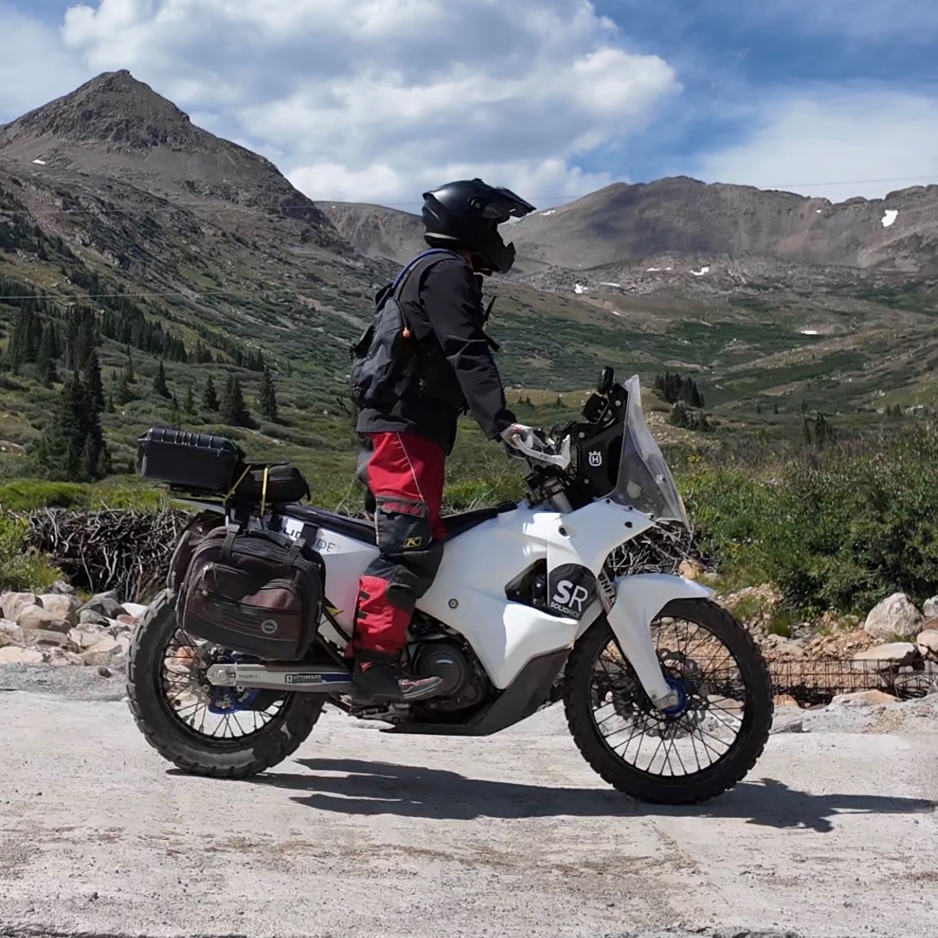
- Tailored Support: From small dual-sport bikes (e.g., Husqvarna 701, KTM 500, XR650, Husqvarna FE501S) to larger adventure rigs (e.g., BMW GS, Honda Africa Twin, Yamaha Ténéré 700), our routes and advisory services are tailored to your specific setup.
- Experience: High-altitude riding presents unique challenges. We provide complete pre-ride checklists, gear recommendations, and emergency preparedness guidance.
Frequently Asked Questions
1. How do SolidRide custom motorcycle travel advisory and GPX route services work?
Our travel advisory service provides field-tested GPX route files engineered specifically for your bike type, riding skill level, and daily mileage preferences. We include local staging advice, fuel stop mapping, mountain pass condition updates, and seasonal route guidance so you can execute a seamless, self-guided Colorado adventure.
2. Do you offer route advisory and support for the COBDR (Colorado Backcountry Discovery Route)?
Yes. We provide complete route advisory, real-time snowpack updates, technical bypass planning, and custom GPX route engineering across all three main sections (South, Central, and North) of the COBDR.
3. Do you rent motorcycles directly?
No, SolidRide does not rent motorcycles directly. However, we partner with trusted local rental providers across Colorado to connect you with late-model, adventure-ready, and dual-sport motorcycles. If you need a bike for one of our guided tours or custom itineraries, we can coordinate with our rental partners to help streamline your reservation and pickup logistics.
4. Do you offer guided tours for ATVs, UTVs, side-by-sides, dirt bikes, or non-street-legal singletrack?
Not at this time. SolidRide specializes exclusively in street-legal adventure (ADV) and dual-sport motorcycle tours, as well as travel advisory services. However, we are always happy to share local insight on Colorado OHV staging areas, non-street-legal trail networks, and recommended local off-road rental outfits to help you plan your trip.
5. Do I need a street-legal motorcycle to ride SolidRide tour routes and Colorado mountain passes?
Yes. Because our tours and route recommendations utilize a mix of paved highways, county gravel roads, and USFS/BLM dirt connectors, your motorcycle must be fully street-legal, registered, and insured. For dirt roads crossing federal lands, riders must also carry a valid Colorado OHV Permit.
6. What is the best time of year for motorcycle travel in Colorado high country?
The primary high-country riding season runs from late June through September. Many mountain passes above 11,000 feet (such as Mosquito Pass or Cottonwood Pass) remain snowbound until mid-to-late June. September offers crisp weather and golden aspen foliage, though early seasonal snowfall can occur at high elevations.
7. What motorcycle gear and setup do I need for high-altitude ADV riding in Colorado?
Weather in the Rocky Mountains can change rapidly. We recommend a versatile, four-season adventure riding suit with removable thermal and waterproof layers. Essential gear includes armored protection, sturdy off-road or ADV boots, cold-weather gloves, and hydration packs. Your motorcycle should be equipped with dual-sport or 50/50 knobby tires, skid plates, handguards, and sufficient fuel range (at least 120–150 miles between stops).
8. How does high altitude affect motorcycle engine performance and fuel range?
At elevations exceeding 10,000 feet, thinner air reduces engine horsepower—typically around 3% for every 1,000 feet of elevation gain on naturally aspirated engines. Fuel-injected (EFI) motorcycles adjust automatically, while carbureted bikes may require re-jetting for optimal performance. High altitude also impacts fuel efficiency, making proper route planning and knowing fuel stop locations critical.
9. Do I need prior off-road riding experience to join a SolidRide tour or request route advisory?
We offer itineraries and route advisories tailored to skill levels ranging from late beginner adventure riders to seasoned dual-sport enthusiasts. Our scenic paved and mild gravel routes are well-suited for riders new to dirt, while our high-alpine pass expeditions require solid off-road balance, clutch control, and confidence on loose scree or rocky terrain. We match your experience to the right tour or custom route.
10. What areas of Colorado does SolidRide cover for tours and advisory?
SolidRide operates statewide. While our administrative headquarters is located in Broomfield, Colorado, our tour operations, GPX route engineering, and trip advisory services cover the entire state—including the San Juan Mountains, Central Rockies, Front Range, Western Slope, and eastern grasslands.
11. What is the difference between an Adventure (ADV) bike route and a Dual-Sport route?
ADV bike routes emphasize sweeping paved byways, wide county gravel roads, and scenic mountain passes that are manageable on mid- to heavy bikes (e.g., BMW GS, Yamaha Ténéré 700). Dual-Sport routes feature tighter doubletrack, steep, rocky climbs, and technical 4WD trails best suited to lighter, street-legal dual-sport motorcycles (e.g., Husqvarna 701, KTM 500/350).
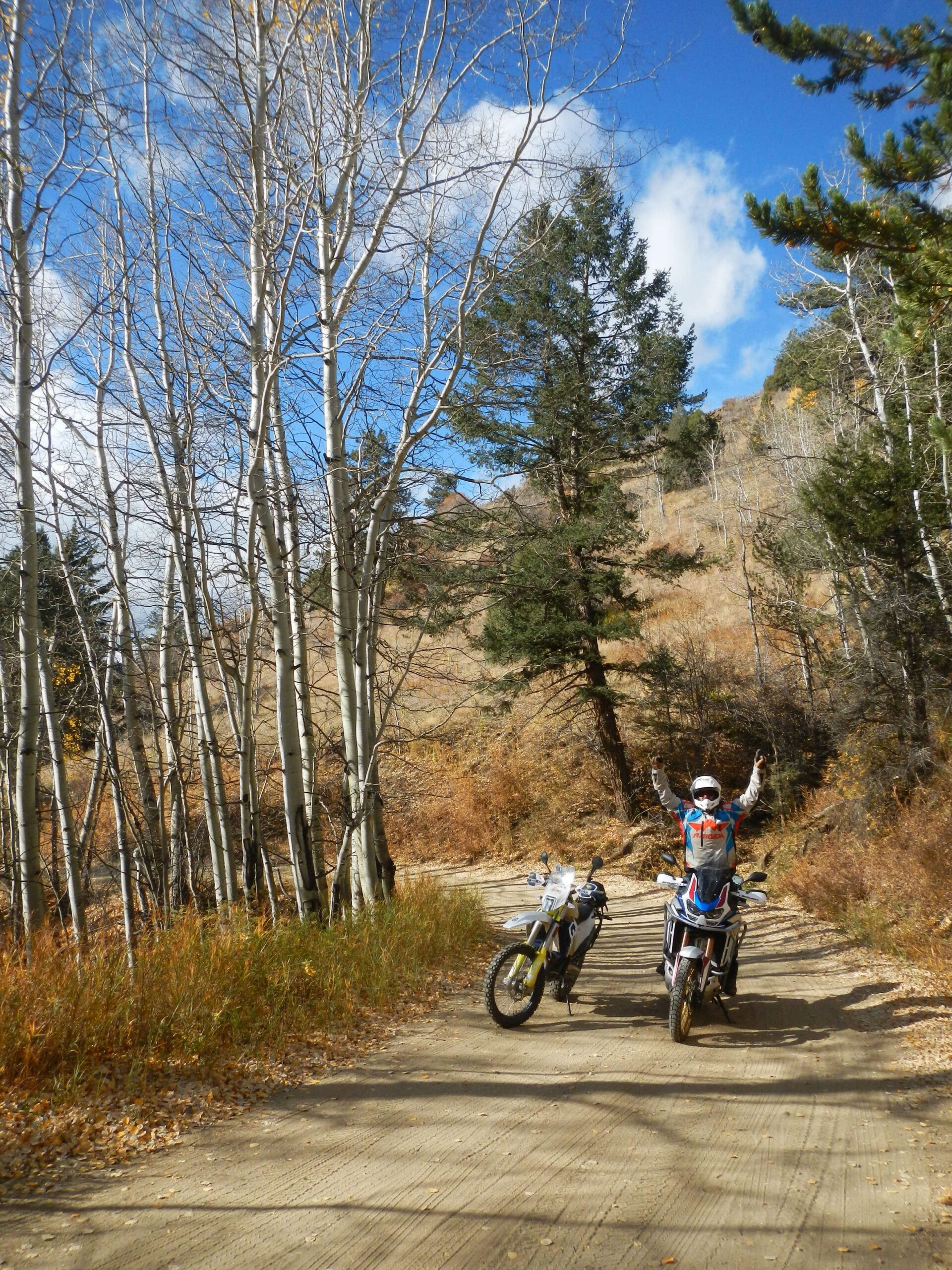
Explore More from SolidRide
Embrace the untamed spirit of adventure as you journey into the heart of Colorado’s high-country. For those who crave the thrill of the open road and the freedom to chart their own course, the high-country of Colorado promises an experience that transcends the ordinary.
Tour Experiences
Discover motorcycle tour experiences in Colorado.
Mountain Towns
Explore tour routes that start/end near major towns.
Mountain Passes
Explore popular tour routes that cross over major mountain passes.